Tofindtheenchantedislands,youmustleaveEcuadorontheSouthAmericanmainlandandtravelwestfor1,000 kilometers(620 miles).FollowtheEquatortoanisolatedclumpofislandsweknowasthe Galápagos.
Fromtheair,someislandslooklikegreengemsspringingupfromthedeepblueocean.Otherislandslookbarren.Youcantrycountingthem.Thereare13largeislands(12shownonourmap),sixsmallerones,andscoresofunnamedrocks.Howdidtheyform,sofarawayfromtherestoftheworld?TheanswerliesinEarth’scrust.Or,morespecifically,thetectonicplatesthatmakeupEarth’scrustandmoveinrelationtoeach other.
FromtheDepths
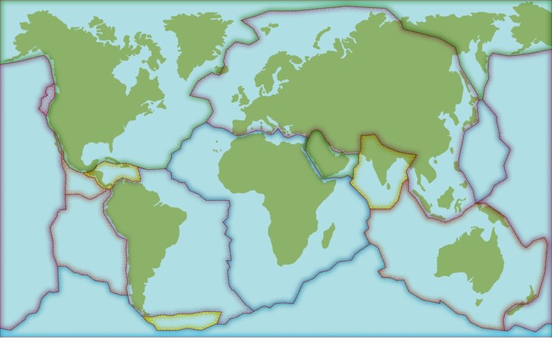
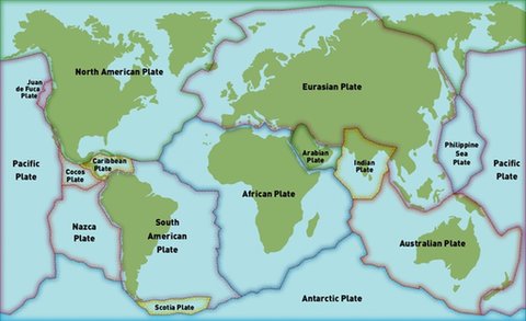
TheGalápagosIslandssitontopofoneofthemostactivevolcanicregionsonEarth.TheseislandslieontheNazcatectonicplate,whichistouchedbyfourother plates.
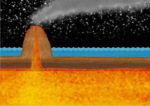
Thisisolatedplaceintheoceanrestsaboveahot spotinEarth’scrustwhereacolumnofhotmagmarises.Whenthemagmareachesthesurface,lavaspewsout.Thelavapilesup.Eventually,avolcano forms.
ThisishowthefirstGalápagosisland,Española,formedmorethanthreemillionyearsago.EachGalápagosisland isvolcanicinnature.Thelargestisland,Isabela,wasformedbysix volcanoesthatmerged together.

ThisaerialviewshowsthevolcaniccratersthatmakeupIsabela Island.
On the Move...
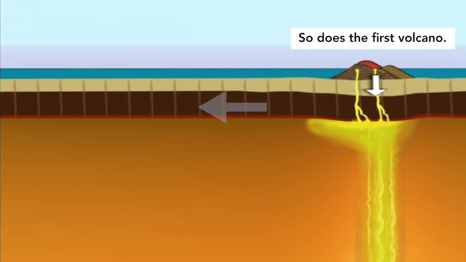
Volcanicactivityexplainshowoneislandformed,buthowweretheotherislandsformed?Thinkbacktotheplates.Remember,theymove.TheNazcaplatemovestowardtheSouthAmericanplateatarateofaround7centimeters(2.7inches)per year.
Theplatesmove,butthehot spotdoesnot.Overtime,EspañolawascarriedsoutheastwardalongwiththeNazcaplate.Thenanewisland—SanCristóbal—formedonthe hot spot.
Thelayoutoftheislandsreflectsthespeedanddirectionofthemovingplate.TheGalápagos’youngestisland,Fernandina,sitsonthehot spotnow.It’samere700,000yearsold.Itsvolcanoeruptedin2009,2017,and 2018.
Beforeyou read
EarthScience
EarthMaterialsandSystems

North
American
Plate
Eurasian Plate
Antarctic Plate
Australian Plate
Philippine
Sea
Plate
Pacific
Plate
Pacific
Plate
Nazca
Plate
South
American
Plate
African Plate
Caribbean
Plate
Arabian
Plate
Indian
Plate
Juan
deFuca
Plate
Cocos
Plate
Scotia Plate


